Showing posts with label impact assessment. Show all posts

Thursday, 30 September 2021

Changing sea levels drive the loss of kelp forests on a rocky shore

In this paper recent published in GeoHazards we evaluated the relationship between sea-level change and the severity of impacts in the major habitat-forming seaweed beds that sustain life on rocky shores.

Threshold effects of relative sea-level change in intertidal ecosystems
https://doi.org/10.3390/geohazards204001641


The 7.8 Mw Kaikōura earthquake affected a large section of the South Island’s east coast and led to a major re-assembly of ecological communities and coastal resource use. To understand the drivers of change and recovery in nearshore ecosystems, we quantified the variation in sea-level change caused by tectonic uplift and evaluated relationships with ecological impacts with a view to establishing the minimum threshold and overall extent of the major effects.

For this assessment we needed to quantify the degree of vertical uplift from the earthquake as close as possible to our post-earthquake study sites in the new intertidal zone. Challenges for this included the availability of elevation data within this area since it was previously covered by water at high tide.We used a methodology based on LiDAR data from the closest adjacent areas to landward that also incorporated an assessment of tilt effects that could lead to uneven ground level displacements, and two time periods to address the potential for continued displacement subsequent to the main seismic event. We also included two different sensitivity analyses to validate the approach used, and assessed interactions with substrate types.

Findings
We found that co-seismic uplift accounted for the majority of  the sea-level change at most locations. However, some changes were detected in the period after the initial earthquake that result from the effects of reef weathering and movement of mobile gravels along the coast. 

Vegetation losses were evident in equivalent intertidal zones at all of the uplifted study sites. Nine of ten uplifted sites suffered severe (>80%) loss in habitat-forming algae and they included the lowest uplift values (0.6 m). The results indicate a functional threshold of approximately one-quarter of the tidal range above which major impacts were sustained. This pattern wasn't entirely explained by the previous position of zone boundaries between the main habitat-forming species in relation to their intertidal position, suggesting that other factors  (additional to sea-level changes) were involved.

One of the interesting effects involved previously subtidal algae such as bull kelp (Durvillaea spp.) individuals that were uplifted into the low intertidal zone where they ought to persist - but did not. This suggests that additional post-dearthquake stressors had contributed to the degree of impact, since otherwise we would have expected to find more survivors in our lower intertidal study areas. Similar effects were found for Hormosira in the mid-intertidal zone. Continuing research has been investigating the nature of these factors. These 'double whammy' situations are evidently important to the regeneration of ecosystems and ecosystem services following a major disturbance, and may also affect the severity of observed mortality events.

Friday, 12 February 2021

Recover newsletter issue 6 on Kaikōura coastal recovery

#RECOVER Issue 6 features the ‘new land’ created by the earthquake uplift of the coastline, recreational uses of beaches in Marlborough, and pāua survey work and hatchery projects with our partners in Kaikōura.

Available online here https://hdl.handle.net/10092/101857

Thursday, 15 October 2020

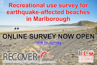
Marlborough beaches recreational survey

Marlborough beach survey

As part of our RECOVER earthquake recovery research the Marine Ecology Research Group has established an online survey to assist the Marlborough community in recording and understanding the level and types of recreational beach uses that are occurring at present on the earthquake-affected coast

We are hoping to capture a comprehensive view of recreational activities and interests. This information will be beneficial to the wider community to support decision-making on earthquake recovery needs and potential strategies for achieving the best outcomes looking ahead. The survey is open to all interested people who are 18+ years of age (for informed consent reasons) and have information they would like to share.

The survey questions are open-ended and allow for any activity, view or perspective to be recorded. Privacy will be maintained at all times and no identifying information is asked for or collected. UC will be preparing summaries of the results and these will be made freely accessible via an online link.

Please access the Marlborough survey on the following link www.surveymonkey.com/r/MarlboroughBeachSurvey


Friday, 26 June 2020

Recover newsletter issue 5 on Kaikōura coastal recovery

#RECOVER Issue 5 features lab work on seaweed responses to stressors and drone survey work to
quantify earthquake impacts and recovery along 130 km of coastline in the intertidal zone

Available online here https://hdl.handle.net/10092/100932

Saturday, 6 June 2020

International interest in drone surveys

It was great too see a recent article Barbara Barkhausen in a German magazine focussing on New Zealand's environment and appeal as a tourism destination.

Read the online version here:
http://www.360grad-neuseeland.de/index.php?option=com_content&view=article&id=3072:so-erholt-sich-die-natur-nach-einem-erdbeben&catid=68&Itemid=62

See more aerial images on our Feacebook page here

Wednesday, 31 July 2019

Friday, 31 May 2019

Quantifying earthquake impacts using drones

A recent Stuff article by Alice Angeloni featured our survey work using drones to map recovery processes on the Kaikōura coast.

We have completed a variety of these high-resolution surveys to investigate diverse aspects of recovery that include habitat shifts and vegetation recovery at our study sites. The sites themselves are characterised by a a variety of environmental conditions and different degrees of uplift resulting from the earthquake event. The high degree of spatiotemporal variation makes the identification of overall impact a challenging task!

https://www.stuff.co.nz/environment/121606479/drone-shots-show-marine-recovery-along-quakestricken-kaikoura-coast

Tuesday, 26 March 2019

Whitebait spawning in Lyell Creek Waikōau

Nice article in the Kaikōura Star on our surpise finding of whitebait spawning sites in downstown Kaikōura.

The spawning habitat in this area has benefitted from riparian restoration work in Lyell Creek / Waikōau since the earthquakes.

Tuesday, 29 January 2019

Recover newsletter issue 2 on Kaikōura coastal recovery


#RECOVER Issue 2 features paua population monitoring, hotspots for banded dotterels, and seaweed recovery experiments from the Kaikōura coast.

Available online here http://hdl.handle.net/10092/16796

Thursday, 21 June 2018

Recovery of near-shore environments from impacts of Kaikoura the earthquake

This article provides a summary of changes to the nearshore ecosystem resulting from uplift effects of the Kaikōura earthquake.

Our MBIE funded RECOVER project will be assessing initial recovery trajectories over a 130 km section of the earthquake-impacted coast.

Read more in NZ Coastal Society Special Publication 'Shaky Shores'
https://www.coastalsociety.org.nz/media/view/publications/shaky-shores-coastal-impacts-and-responses-to-the-2016-kaikoura-earthquakes/

Monday, 11 June 2018

Earthquakes cause the relocation of spawning habitat on a catchment scale

The story of how whitebait spawning sites shifted to new areas after the Canterbury earthquakes - and became exposed to new vulnerabilities.
This spatial ecology study reveals how and where we can take action to protect them.


Read more here

Monday, 6 November 2017

New methods paper - Census survey approach for īnanga spawning habitat

Waterways and MERG have recently published details of a survey methodology for locating and mapping īnanga spawning sites near coastal rivermouths. 

Read more here.


Wednesday, 1 November 2017

Evaluation of Christchurch City Council's riparian management trial

Christchurch City Council (CCC) recently changed its riparian vegetation clearance practices for a trial period in the summer of 2016/17. While the trial has wider objectives around improved environmental outcomes, īnanga spawning habitat is directly affected by bank cutting and other forms of vegetation clearance. A survey of īnanga (Galaxias maculatus) spawning habitat was completed in April 2017 to evaluate effects of the trial.

Benefits of the trial included increasing the availability of high quality spawning habitat and the discovery of new spawning sites. The Avon/Ōtākaro supported a relatively high area of occupation (AOO) of spawning sites for a single month in comparison to other years. In the Heathcote/Ōpāwaho spawning was found at new sites including upstream of Opawa Road. However, egg production was relatively low in the Heathcote/Ōpāwaho versus the same month in previous years. This suggests a shift in the month of peak spawning activity or a possible adult population decline and requires consecutive month surveys to confirm the actual trend.

The full report is available on the CCC website here:
Response of īnanga spawning habitat to riparian vegetation management

Monday, 12 June 2017

NZ's largest known area of inanga spawning found in Christchurch waterways!

An unexpected result of our earthquake studies was the discovery that  īnanga spawning habitat had expanded, and was more extensive than ever previously recorded in Christchurch's waterways.

Further surveys in 2016 found that even larger areas were being used. The total area of spawning was around 2x
the next largest area recorded anywhere in New Zealand !

Read more >>

Friday, 10 July 2015

Earthquakes cause a shift in the location of īnanga spawning sites

One of the main objectives for our whitebait conservation study was to determine if the earthquakes had altered the location of spawning sites for īnanga (Galaxias maculatus) for spawning. They are typically found in specific locations near the freshwater-saltwater interface at rivermouths. As such, īnanga spawning sites are potentially a very good indicator of change. Conversely, they may be especially vulnerable to changes that affect the availability or condition of suitable habitat.

And the answer is - yes, there has been a major shift in the location of spawning compared to all previous records!

Read more here

Contact Form

Name

Email *

Message *

Pageviews