Thursday 30 September 2021

Relationship between changing sea levels and loss of seaweed on a rocky shore

In this paper recent published in GeoHazards we evaluated the relationship between sea-level change and the severity of impacts in the major habitat-forming seaweed beds that sustain life on rocky shores.

Threshold effects of relative sea-level change in intertidal ecosystems
https://doi.org/10.3390/geohazards204001641


The 7.8 Mw Kaikōura earthquake affected a large section of the South Island’s east coast and led to a major re-assembly of ecological communities and coastal resource use. To understand the drivers of change and recovery in nearshore ecosystems, we quantified the variation in sea-level change caused by tectonic uplift and evaluated relationships with ecological impacts with a view to establishing the minimum threshold and overall extent of the major effects.

For this assessment we needed to quantify the degree of vertical uplift from the earthquake as close as possible to our post-earthquake study sites in the new intertidal zone. Challenges for this included the availability of elevation data within this area since it was previously covered by water at high tide.We used a methodology based on LiDAR data from the closest adjacent areas to landward that also incorporated an assessment of tilt effects that could lead to uneven ground level displacements, and two time periods to address the potential for continued displacement subsequent to the main seismic event. We also included two different sensitivity analyses to validate the approach used, and assessed interactions with substrate types.

Findings
We found that co-seismic uplift accounted for the majority of  the sea-level change at most locations. However, some changes were detected in the period after the initial earthquake that result from the effects of reef weathering and movement of mobile gravels along the coast. 

Vegetation losses were evident in equivalent intertidal zones at all of the uplifted study sites. Nine of ten uplifted sites suffered severe (>80%) loss in habitat-forming algae and they included the lowest uplift values (0.6 m). The results indicate a functional threshold of approximately one-quarter of the tidal range above which major impacts were sustained. This pattern wasn't entirely explained by the previous position of zone boundaries between the main habitat-forming species in relation to their intertidal position, suggesting that other factors  (additional to sea-level changes) were involved.

One of the interesting effects involved previously subtidal algae such as bull kelp (Durvillaea spp.) individuals that were uplifted into the low intertidal zone where they ought to persist - but did not. This suggests that additional post-dearthquake stressors had contributed to the degree of impact, since otherwise we would have expected to find more survivors in our lower intertidal study areas. Similar effects were found for Hormosira in the mid-intertidal zone. Continuing research has been investigating the nature of these factors. These 'double whammy' situations are evidently important to the regeneration of ecosystems and ecosystem services following a major disturbance, and may also affect the severity of observed mortality events.

Friday 12 February 2021

Recover newsletter issue 6 on Kaikōura coastal recovery

#RECOVER Issue 6 features the ‘new land’ created by the earthquake uplift of the coastline, recreational uses of beaches in Marlborough, and pāua survey work and hatchery projects with our partners in Kaikōura.

Available online here https://hdl.handle.net/10092/101857

Monday 8 February 2021

Whitebait spawning grounds at non-tidal rivermouths

We recently published a study of īnanga (Galaxias maculatus) spawning grounds at non-tidal rivermouths in Pacific Conservation Biology

http://bit.ly/non-tidal-spawning_PCB
Article freely available here

Non-tidal rivermouths are common on the east coast of the South island and south-east of the North Island where they are commonly associated with high energy mixed sand-gravel beaches that form perched lagoons or hāpua at the rivermouth. 

At the outset of the study the spatial pattern of spawning in these environments grounds was unknown. Some of the interesting findings were that the location of spawning was close to the rivermouth despite the lack of salt water intrusion or tidal influence, both of which are associated with spawning grounds in tidal situations. 

A downstream fish migration evidently still occurs prior to spawning events and fish movements were surprisingly rapid in response to spawning cues in many instances. Spawning events are triggered by water level changes as occurs in tidal rivermouths, but appear to be more haphazard due to their origins being rain events rather than regular tidal cycles.Geographical aspects of the spawning locations were remarkably consistent across all seven study sites in key aspects such as the position in the catchment, relationship with water changes and presence of riparian vegetation. 

This provides a solid basis for identifying and managing spawning habitat in other non-tidal rivers. Effects we recorded included spawning on flood events that resulted in spawning grounds being located some distance from the active channel. As with tidal situations this places the eggs at risk from human activities in those same zones, but potentially presents a more difficult management proposition due to these events being less predictable. Their irregular nature suggests they are less likely to be accommodated in riparian zone planning and management. Importantly, the spawning grounds are located close to the peak water levels experienced on these events, which coincides with areas that are only briefly inundated. 

Recognising and protecting these emphemeral flood-zone areas is the key to effective conservation.

Read the full article here


Thursday 26 November 2020

Beach dynamics and recreational access change

https://bit.ly/MarlboroughBeachReport
Link to report

The report responds to a request from Marlborough District Council (MDC) for information on the coastal environment, with a particular focus on supporting the development of a bylaw to address changes in recreational use patterns that have occurred since the Kaikōura earthquakeWe present a selection of information from our earthquake recovery research that has a focus on understanding the impacts and ongoing processes of change. 

Major impacts of the natural disaster are associated with vertical uplift of the coastal environment, although ongoing erosion and deposition processes are also important. Interactions with human activities are also important because they can exert strong influences on the reassembly of ecosystems which is a critical aspect of outcomes over the longer-term. 

Earthquake uplift caused widespread mortality of many coastal habitats and species (e.g., algal assemblages) that are adapted to a relatively specific set of conditions, often associated with characteristic locations in relation to the tidal range. In uplifted areas the intertidal zone has moved seaward leading to a physical widening of many beaches. This has provided greater opportunity for off-road vehicle access to the coast and has become particularly noticeable at headlands and other natural barriers that were previously impassable at high tide. Off-road vehicles pose threats to sensitive vegetation and wildlife unless appropriately managed. Achieving this is assisted by an understanding of the specific impacts of vehicle use, which in turn requires information on the location of sensitive areas. 

To ensure the best outcomes for earthquake recovery there is an urgent need to assess and respond to the new spatial patterns, and to make plans to avoid conflicts where possible.

Thursday 15 October 2020

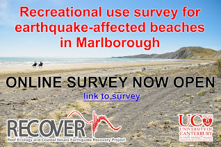
Marlborough beaches recreational survey

Marlborough beach survey

As part of our RECOVER earthquake recovery research the Marine Ecology Research Group has established an online survey to assist the Marlborough community in recording and understanding the level and types of recreational beach uses that are occurring at present on the earthquake-affected coast

We are hoping to capture a comprehensive view of recreational activities and interests. This information will be beneficial to the wider community to support decision-making on earthquake recovery needs and potential strategies for achieving the best outcomes looking ahead. The survey is open to all interested people who are 18+ years of age (for informed consent reasons) and have information they would like to share.

The survey questions are open-ended and allow for any activity, view or perspective to be recorded. Privacy will be maintained at all times and no identifying information is asked for or collected. UC will be preparing summaries of the results and these will be made freely accessible via an online link.

Please access the Marlborough survey on the following link www.surveymonkey.com/r/MarlboroughBeachSurvey


Wednesday 19 August 2020

Risk factors for coastal conservation revealed by the Canterbury earthquakes

We're pleased to announce publication of the companion paper to ‘Coastal tectonics and habitat squeeze’ in the international journal Science of the Total Environment.

dx.doi.org/10.1016/j.scitotenv.2020.141241

This paper investigates the resilience of coastal vegetation to the effects of relative sea-level change which is the subject of very few empirical studies due to the scarcity of sea-level change events of appreciable magnitude in modern times. The novel opportunity provided by the Canterbury earthquakes allowed us to design a robust impact assessment to quantify effects and identify anthropogenic factors that influenced the pattern of losses or gains. 

The findings illustrate opportunities for managing risks to coastal vegetation types such as saltmarsh which are threatened by sea-level rise. 

The conservation of these characteristic ecosystems is of global importance for the sequestration and storage of blue carbon alongside many other ecosystem services that include considerable habitat values for characteristic wildlife such as waders and shorebirds in the Christchurch case.

In summarising results from the study we derived four key principles for building the resilience of coastal ecosystems that will be of interest to coastal managers worldwide.


Monday 13 July 2020

Coastal tectonics and habitat squeeze

We're pleased to announce publication of a new paper in the international journal Natural Hazards.
This is the first chapter in the 'Resilient Shorelines' Ph.D. 

dx.doi.org/10.1007/s11069-020-04147-w

The Canterbury earthquakes provided a rare opportunity to observe the actual effects of a sea-level rise event. This study explores the impacts of hydrological changes resulting from tectonic ground movement in low-lying coastal environments, and draws analogies with future climate change.


The paper describes landscape-scale changes and assess interactions with human land-use patterns and disaster recovery responses that include a large scale managed retreat. The results illustrate mechanisms by which 'coastal squeeze' effects may occur with sea-level rise - and also ways to avoid them through innovative planning and design.  

Principles identifiable from the actual impacts in this case provide useful insights for other situations of sea-level rise.

We highlight the need for an improved focus on whole-system resilience in responding to sea-level changes, and the importance of disaster recovery processes for adaptation to climate change.

Friday 26 June 2020

Recover newsletter issue 5 on Kaikōura coastal recovery

#RECOVER Issue 5 features lab work on seaweed responses to stressors and drone survey work to
quantify earthquake impacts and recovery along 130 km of coastline in the intertidal zone

Available online here https://hdl.handle.net/10092/100932

Saturday 6 June 2020

International interest in drone surveys

It was great too see a recent article Barbara Barkhausen in a German magazine focussing on New Zealand's environment and appeal as a tourism destination.

Read the online version here:
http://www.360grad-neuseeland.de/index.php?option=com_content&view=article&id=3072:so-erholt-sich-die-natur-nach-einem-erdbeben&catid=68&Itemid=62

See more aerial images on our Feacebook page here

Thursday 19 December 2019

Recover newsletter issue 4 on Kaikōura coastal recovery

 #RECOVER Issue 4 features work on seaweed recovery in the subtidal zone, ecological engineering in Waikoau / Lyell Creek, and a preview of drone survey results.

Available online here https://hdl.handle.net/10092/100102

Wednesday 31 July 2019

Thursday 20 June 2019

Kaikōura earthquake recovery - loss of connectivity and the necessity of a cross‐ecosystem perspective

Article just published in Aquatic Conservation: Marine and Freshwater Resources from our Kaikōura earthquake recovery work.

The Kaikōura earthquake in southern New Zealand: Loss of connectivity of marine communities and the necessity of a cross‐ecosystem perspective.
https://doi.org/10.1002/aqc.3122

Monday 3 June 2019

Stuff article on Kaikōura whitebait

Great article by Sophie Trigger at the Marlborough Express that features our recent work investigating earthquake impacts on river mouths along the Kaikōura coast.

We were able to locate several whitebait spawning sites and made some interesting discoveries with many of them occurring on flood events. Read more about an ecological experiment to rescue eggs stranded high on the riverbank with the help of the Environment Canterbury flood management team.
https://www.stuff.co.nz/environment/112863187/kaikura-whitebait-discovery-could-have-flowon-effects

Friday 31 May 2019

Quantifying earthquake impacts using drones

A recent Stuff article by Alice Angeloni featured our survey work using drones to map recovery processes on the Kaikōura coast.

We have completed a variety of these high-resolution surveys to investigate diverse aspects of recovery that include habitat shifts and vegetation recovery at our study sites. The sites themselves are characterised by a a variety of environmental conditions and different degrees of uplift resulting from the earthquake event. The high degree of spatiotemporal variation makes the identification of overall impact a challenging task!

https://www.stuff.co.nz/environment/121606479/drone-shots-show-marine-recovery-along-quakestricken-kaikoura-coast

Tuesday 26 March 2019

Whitebait spawning in Lyell Creek Waikōau

Nice article in the Kaikōura Star on our surpise finding of whitebait spawning sites in downstown Kaikōura.

The spawning habitat in this area has benefitted from riparian restoration work in Lyell Creek / Waikōau since the earthquakes.

Monday 25 March 2019

Whitebait spawning surveys in Kaikōura coastal rivers

This summer we've been working
to fill a knowledge gap about whitebait in streams and rivers along the Kaikōura coast. Knowing where they are is useful for recovery planning in the same areas post-earthquake as well as for restoration projects in local waterways.

Our survey programme started with fish trapping to find out which species were living in which rivers, after which we selected waterways that were suspected to have good īnanga populations. They included seven catchments close to Kaikōura (Oaro, Kahutara, Lyell / Waikōau, Middle, Swan, Harnetts and Blue Duck) as well as other sites in Marlborough. After four months of surveying we discovered at least one spawning event in all of these streams and rivers and were able to map the spawning locations including some large sites!

Tuesday 29 January 2019

Recover newsletter issue 2 on Kaikōura coastal recovery


#RECOVER Issue 2 features paua population monitoring, hotspots for banded dotterels, and seaweed recovery experiments from the Kaikōura coast.

Available online here http://hdl.handle.net/10092/16796

Wednesday 21 November 2018

Te Tiaki Inanga project with Department of Conservation


It was fantastic to see some of our work communicated in the new Department of Conservation brochure on using straw bales as temporary īnanga spawning habitat

This project was a truly a collaborative effort thanks to Helen Kettles in the National Estuaries team (thanks Helen!)The team included Helen Kettles, Martin Rutledge, Leana Barriball, Sarah Wilcox, Peter Badalamenti and Laurence Walls (DOC), Pātaka Moore and Caleb Royal (Te Wānanga o Raukawa), and Mike Hickford and myself from the University of Canterbury.

Our kaupapa included piloting a draft version of the resource with several community groups across New Zealand, and their feedback added extra value to the finsihed result. Some of the key people and groups involved were Te Kura Kaupapa Māori o Ngā Mokopuna (Te Whanganui a Tara), Te Kura Kaupapa Māori o Te Rito (Ōtaki), Te Kura a Iwi o Whakatupuranga Rua Mano (Ōtaki), Brooke Ashleigh Turner (DOC, Living Waters) and Jason Roxburgh (Living Matters – Biodiversity & Ecology Solutions), Grant and Rosemary Webby (Waiwhetu Stream Care), Henk Stengs (DOC) and the Cobden Aromahana Ecological Restoration Group.

We were also fortunate to have specialist expertise and advice for preparing a Te Reo translation and whakapapa design thanks to Ruiha Leonard and Sian Montgomery-Neutze.

Check out the Te Reo Māori and English versions of the Te Tiaki Īnanga brochure here:

Read more about the Te Tiaki Īnanga project on the DOC website here
This was an awesome project and we hope it will assist other community restoration groups interested in using this technique.

He iti te mokoroa nāna te kahikatea i kakati
Even the small can make a big impact!

Thursday 25 October 2018

Inanga ora ki te awa o Waitara

It's been great working on this project with Waitara Alive and the Ōtaraua Hapū along with Waitara High School students to better understand the health of whitebait spawning sites along the Waitara River. 
The project is comparing present day spawning site health and abundance to historical evidence collected from local kaumatua. By contrasting past with present, the Inanga Ora project team hope to identify how spawning habitat is changing, and what can be done to better protect it.

The project was funded by the 'Curious Minds' He Hihiri I Te Mahara. Participatory Science Platform.
Check out a recent update from the Venture Taranaki here

Thursday 21 June 2018

Recovery of near-shore environments from impacts of Kaikoura the earthquake

This article provides a summary of changes to the nearshore ecosystem resulting from uplift effects of the Kaikōura earthquake.

Our MBIE funded RECOVER project will be assessing initial recovery trajectories over a 130 km section of the earthquake-impacted coast.

Read more in NZ Coastal Society Special Publication 'Shaky Shores'
https://www.coastalsociety.org.nz/media/view/publications/shaky-shores-coastal-impacts-and-responses-to-the-2016-kaikoura-earthquakes/

Monday 11 June 2018

Earthquakes cause the relocation of spawning habitat on a catchment scale

The story of how whitebait spawning sites shifted to new areas after the Canterbury earthquakes - and became exposed to new vulnerabilities.
This spatial ecology study reveals how and where we can take action to protect them.


Read more here

Tuesday 5 June 2018

Using artificial habitats as a natural habitat detection tool


We have a new paper published in the journal Ecological Indicators that describes the science behind using artificial habitats (such as straw bales) to as a detection tool.

We used this approach to help identify īnanga spawning habitat in degraded waterways where egg mortality can make it difficult to find the eggs directly.

Read more here

Monday 6 November 2017

New methods paper - Census survey approach for īnanga spawning habitat

Waterways and MERG have recently published details of a survey methodology for locating and mapping īnanga spawning sites near coastal rivermouths. 

Read more here.


Wednesday 1 November 2017

Evaluation of Christchurch City Council's riparian management trial

Christchurch City Council (CCC) recently changed its riparian vegetation clearance practices for a trial period in the summer of 2016/17. While the trial has wider objectives around improved environmental outcomes, īnanga spawning habitat is directly affected by bank cutting and other forms of vegetation clearance. A survey of īnanga (Galaxias maculatus) spawning habitat was completed in April 2017 to evaluate effects of the trial.

Benefits of the trial included increasing the availability of high quality spawning habitat and the discovery of new spawning sites. The Avon/Ōtākaro supported a relatively high area of occupation (AOO) of spawning sites for a single month in comparison to other years. In the Heathcote/Ōpāwaho spawning was found at new sites including upstream of Opawa Road. However, egg production was relatively low in the Heathcote/Ōpāwaho versus the same month in previous years. This suggests a shift in the month of peak spawning activity or a possible adult population decline and requires consecutive month surveys to confirm the actual trend.

The full report is available on the CCC website here:
Response of īnanga spawning habitat to riparian vegetation management

Monday 19 June 2017

Floodplain planning - a case study on regeneration oppportunities in a post-disaster setting

We're pleased to announce the findings of a three-part study on ecological 'regeneration' opportunities for the red-zoned lands in Avon / Ōtākaro river corridor. The study was supported by Avon-Ōtākaro Network in collaboration with Avon-Ōtākaro Forest Park and Greening the Red Zone.

This study provides an analysis of considerations for land-use planning (including sea level rise), with a focus on opportunities for ecological restoration and building resilience to climate change.

Monday 12 June 2017

NZ's largest known area of inanga spawning found in Christchurch waterways!

An unexpected result of our earthquake studies was the discovery that  īnanga spawning habitat had expanded, and was more extensive than ever previously recorded in Christchurch's waterways.

Further surveys in 2016 found that even larger areas were being used. The total area of spawning was around 2x
the next largest area recorded anywhere in New Zealand !

Read more >>

Monday 5 June 2017

New spawning sites found in Aromahana Lagoon in Greymouth

Dr. Mike Hickford and I recently visited an community restoration project on Cobden Island in the Grey River and nearby Aromahana Lagoon. Our main goal was to scope out a survey strategy for monitoring īnanga spawning in this area. Time was short but we did manage to find two new spawning sites. 

This is an innovative floodplain restoration project on an impressive scale. Thanks to Henk Stengs at DOC for showing us around!

Read more >>


Tuesday 3 January 2017

New Zealand Coastal Society award

Thanks to the New Zealand Coastal Society for the Best Overall Presentation prize at the 2016 New Zealand Coastal Society conference He Waka Eke Noa: Linking Science, Engineering, Management and Community. I was completely taken by surprise given the many excellent speakers!

The conference is held each year and attracts diverse attendance from scientists, engineers, and planners, with presentation covering a wide range of contemporary management topics.

Read more >>

Contact Form

Name

Email *

Message *

Pageviews