Showing posts with label coastal. Show all posts

Thursday, 30 September 2021

Changing sea levels drive the loss of kelp forests on a rocky shore

In this paper recent published in GeoHazards we evaluated the relationship between sea-level change and the severity of impacts in the major habitat-forming seaweed beds that sustain life on rocky shores.

Threshold effects of relative sea-level change in intertidal ecosystems
https://doi.org/10.3390/geohazards204001641


The 7.8 Mw Kaikōura earthquake affected a large section of the South Island’s east coast and led to a major re-assembly of ecological communities and coastal resource use. To understand the drivers of change and recovery in nearshore ecosystems, we quantified the variation in sea-level change caused by tectonic uplift and evaluated relationships with ecological impacts with a view to establishing the minimum threshold and overall extent of the major effects.

For this assessment we needed to quantify the degree of vertical uplift from the earthquake as close as possible to our post-earthquake study sites in the new intertidal zone. Challenges for this included the availability of elevation data within this area since it was previously covered by water at high tide.We used a methodology based on LiDAR data from the closest adjacent areas to landward that also incorporated an assessment of tilt effects that could lead to uneven ground level displacements, and two time periods to address the potential for continued displacement subsequent to the main seismic event. We also included two different sensitivity analyses to validate the approach used, and assessed interactions with substrate types.

Findings
We found that co-seismic uplift accounted for the majority of  the sea-level change at most locations. However, some changes were detected in the period after the initial earthquake that result from the effects of reef weathering and movement of mobile gravels along the coast. 

Vegetation losses were evident in equivalent intertidal zones at all of the uplifted study sites. Nine of ten uplifted sites suffered severe (>80%) loss in habitat-forming algae and they included the lowest uplift values (0.6 m). The results indicate a functional threshold of approximately one-quarter of the tidal range above which major impacts were sustained. This pattern wasn't entirely explained by the previous position of zone boundaries between the main habitat-forming species in relation to their intertidal position, suggesting that other factors  (additional to sea-level changes) were involved.

One of the interesting effects involved previously subtidal algae such as bull kelp (Durvillaea spp.) individuals that were uplifted into the low intertidal zone where they ought to persist - but did not. This suggests that additional post-dearthquake stressors had contributed to the degree of impact, since otherwise we would have expected to find more survivors in our lower intertidal study areas. Similar effects were found for Hormosira in the mid-intertidal zone. Continuing research has been investigating the nature of these factors. These 'double whammy' situations are evidently important to the regeneration of ecosystems and ecosystem services following a major disturbance, and may also affect the severity of observed mortality events.

Friday, 12 February 2021

Recover newsletter issue 6 on Kaikōura coastal recovery

#RECOVER Issue 6 features the ‘new land’ created by the earthquake uplift of the coastline, recreational uses of beaches in Marlborough, and pāua survey work and hatchery projects with our partners in Kaikōura.

Available online here https://hdl.handle.net/10092/101857

Monday, 8 February 2021

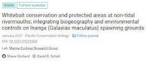
Biogeography of Whitebait spawning grounds at non-tidal rivermouths

We recently published a study of īnanga (Galaxias maculatus) spawning grounds at non-tidal rivermouths in Pacific Conservation Biology

http://bit.ly/non-tidal-spawning_PCB
Article freely available here

Non-tidal rivermouths are common on the east coast of the South island and south-east of the North Island where they are commonly associated with high energy mixed sand-gravel beaches that form perched lagoons or hāpua at the rivermouth. 

At the outset of the study the spatial pattern of spawning in these environments grounds was unknown. Some of the interesting findings were that the location of spawning was close to the rivermouth despite the lack of salt water intrusion or tidal influence, both of which are associated with spawning grounds in tidal situations. 

A downstream fish migration evidently still occurs prior to spawning events and fish movements were surprisingly rapid in response to spawning cues in many instances. Spawning events are triggered by water level changes as occurs in tidal rivermouths, but appear to be more haphazard due to their origins being rain events rather than regular tidal cycles.Geographical aspects of the spawning locations were remarkably consistent across all seven study sites in key aspects such as the position in the catchment, relationship with water changes and presence of riparian vegetation. 

This provides a solid basis for identifying and managing spawning habitat in other non-tidal rivers. Effects we recorded included spawning on flood events that resulted in spawning grounds being located some distance from the active channel. As with tidal situations this places the eggs at risk from human activities in those same zones, but potentially presents a more difficult management proposition due to these events being less predictable. Their irregular nature suggests they are less likely to be accommodated in riparian zone planning and management. Importantly, the spawning grounds are located close to the peak water levels experienced on these events, which coincides with areas that are only briefly inundated. 

Recognising and protecting these emphemeral flood-zone areas is the key to effective conservation.

Read the full article here


Thursday, 15 October 2020

Marlborough beaches recreational survey

Marlborough beach survey

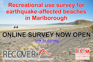
As part of our RECOVER earthquake recovery research the Marine Ecology Research Group has established an online survey to assist the Marlborough community in recording and understanding the level and types of recreational beach uses that are occurring at present on the earthquake-affected coast

We are hoping to capture a comprehensive view of recreational activities and interests. This information will be beneficial to the wider community to support decision-making on earthquake recovery needs and potential strategies for achieving the best outcomes looking ahead. The survey is open to all interested people who are 18+ years of age (for informed consent reasons) and have information they would like to share.

The survey questions are open-ended and allow for any activity, view or perspective to be recorded. Privacy will be maintained at all times and no identifying information is asked for or collected. UC will be preparing summaries of the results and these will be made freely accessible via an online link.

Please access the Marlborough survey on the following link www.surveymonkey.com/r/MarlboroughBeachSurvey


Wednesday, 19 August 2020

Risk factors for coastal conservation revealed by the Canterbury earthquakes

We're pleased to announce publication of the companion paper to ‘Coastal tectonics and habitat squeeze’ in the international journal Science of the Total Environment.

dx.doi.org/10.1016/j.scitotenv.2020.141241

This paper investigates the resilience of coastal vegetation to the effects of relative sea-level change which is the subject of very few empirical studies due to the scarcity of sea-level change events of appreciable magnitude in modern times. The novel opportunity provided by the Canterbury earthquakes allowed us to design a robust impact assessment to quantify effects and identify anthropogenic factors that influenced the pattern of losses or gains. 

The findings illustrate opportunities for managing risks to coastal vegetation types such as saltmarsh which are threatened by sea-level rise. 

The conservation of these characteristic ecosystems is of global importance for the sequestration and storage of blue carbon alongside many other ecosystem services that include considerable habitat values for characteristic wildlife such as waders and shorebirds in the Christchurch case.

In summarising results from the study we derived four key principles for building the resilience of coastal ecosystems that will be of interest to coastal managers worldwide.


Friday, 26 June 2020

Recover newsletter issue 5 on Kaikōura coastal recovery

#RECOVER Issue 5 features lab work on seaweed responses to stressors and drone survey work to
quantify earthquake impacts and recovery along 130 km of coastline in the intertidal zone

Available online here https://hdl.handle.net/10092/100932

Thursday, 21 June 2018

Recovery of near-shore environments from impacts of Kaikoura the earthquake

This article provides a summary of changes to the nearshore ecosystem resulting from uplift effects of the Kaikōura earthquake.

Our MBIE funded RECOVER project will be assessing initial recovery trajectories over a 130 km section of the earthquake-impacted coast.

Read more in NZ Coastal Society Special Publication 'Shaky Shores'
https://www.coastalsociety.org.nz/media/view/publications/shaky-shores-coastal-impacts-and-responses-to-the-2016-kaikoura-earthquakes/

Monday, 19 June 2017

Floodplain planning - a case study on regeneration oppportunities in a post-disaster setting

We're pleased to announce the findings of a three-part study on ecological 'regeneration' opportunities for the red-zoned lands in Avon / Ōtākaro river corridor. The study was supported by Avon-Ōtākaro Network in collaboration with Avon-Ōtākaro Forest Park and Greening the Red Zone.

This study provides an analysis of considerations for land-use planning (including sea level rise), with a focus on opportunities for ecological restoration and building resilience to climate change.

Tuesday, 3 January 2017

New Zealand Coastal Society award

Thanks to the New Zealand Coastal Society for the Best Overall Presentation prize at the 2016 New Zealand Coastal Society conference He Waka Eke Noa: Linking Science, Engineering, Management and Community. I was completely taken by surprise given the many excellent speakers!

The conference is held each year and attracts diverse attendance from scientists, engineers, and planners, with presentation covering a wide range of contemporary management topics.

Read more >>

Thursday, 17 November 2016

Spawning habitat maps for Ōtautahi waterways

These maps show results from two years of spawning site surveys plus two years of straw bale experiments in the waterways of Ōtautahi Christchurch. Compare them with the Whaka Inaka maps where we took all of the known sites at the end of 2015 and tested if there might be others both in the gaps and further upstream/downstream. And yes there were.
These maps are available as free downloads. There's some other maps available too ..
check them out here www.resilientshorelines.nz/p/resources.html

Thursday, 15 September 2016

Workshop on coastal & marine citizen science


                   Link to the full report here


I teamed up with Helen Kettles (DOC) to run a workshop on Coastal & Marine Citizen Science in New Zealand as a side event for the NZ Marine Sciences Society (NZMSS) and Australian Marine Sciences Association (AMSA) 2016 conference in Wellington. This was a first meeting specific to coastal and marine citizen science in New Zealand. A group of 29 participants attended and there was a strong Australian contingent which added a welcome dimension to the conversation.

Friday, 19 August 2016

Using citizen science for coastal data collection

Citizen science has come of age in New Zealand and there are a wide range of opportunities for coastal scientists and practitioners to make use of, or contribute to it.

This recent article in Coastal News provides an overview of some recent highlights and progress in this fast moving field.

Read more >>


Thursday, 30 June 2016

Case study on community-led restoration projects and climate change

A case study of three coastal restoration projects looking at community-led approaches and climate change is in the new publication "Adapting to the consequences of climate change: Engaging with communities".

Link to the article here "Community-led approaches and climate change: Perspectives from coastal restoration projects"

The aim of this new NZCS publication is to support work with communities as they adapt to the consequences of climate change. It has been written to assist coastal professionals, decision-makers and communities in preparing for sea-level rise and the associated effects of climate change.

Monday, 27 June 2016

Ngāi Tahu Research Centre seminar: earthquake recovery in Ōtautahi Christchurch watwerways


Results from our research into the effects of the Canterbury earthquakes on īnanga spawning sites in the Avon Heathcote Estuary / Ihutai catchment in Ōtautahi Christchurch. It's a story of the resilience and recovery of an iconic New Zealand species following a major disturbance. Thanks to the Ngāi Tahu Research Centre and UC Audio Visual unit the recent seminar was videoed. View the clip on U-tube here.

Thursday, 17 March 2016

New report on earthquake effects

The Waterways Centre for Freshwater Research and the Marine Ecology Research Group are pleased to provide a new report on the distribution of īnanga spawning sites in Ōtautahi Christchurch. Thanks to the Engineering New Zealand / Water NZ Rivers Group for supporting this work.
Highlights include comprehensive information on changes in relation to the Canterbury earthquakes, and a summary of the key implications for waterways management.


Wednesday, 16 March 2016

Comparative study of coastal hydrosystems

Over the 2016 summer we are surveying eight coastal hydrosystems for a comparative study. Four study sites are in Canterbury and four on the West Coast. The study sites have been chosen to represent a range of different rivermouth and estuarine environments and a wide range of data are being collected to characterise each site in ecosystem terms. Look out for more news from these surveys in the coming months.

Tuesday, 1 December 2015

2015 hottest year on record?

This recent information from NOAA is worth a look. It that shows very warm global conditions have prevailed since January.
 
via GIPHY

Read more about the trend versus historical averages on the Think Progress site here.

And some recent comment on the 10 things you need to know about climate change with implications for New Zealand.

There's a lot going on in the lead-up to the COP21 climate change summit in Paris ... watch this space!

Thursday, 1 October 2015

Whaka Inaka project gaining media attention


Whaka Inaka: Causing Whitebait is a joint collaboration between EOS Ecology, Ngāi Tahu, and the University of Canterbury (UC). We recently receiving funding from the Department of Conservation Community Fund, and together with support from Brian Mason Trust, and businesses such as Ravensdown the project is getting underway!

Friday, 11 September 2015

Coastal Restoration Trust award

A big thank you to the Dunes Trust  for adding their support to our to our dune management case study.

Visit www.dunestrust.org.nz for more information on conservation and restoration New Zealand’s dune ecosystems.

Contact Form

Name

Email *

Message *

Pageviews